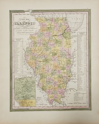
A New Map of Illinois with Its Proposed Canals, Roads & Distances from place to place along the Stage & Steam Boat Routes
Philadelphia: H. S. Tanner, 1841. Map. Bright color map [43 cm x 35 cm] / [17 x 14"]. Bold and colorful. Plate 31 from "A New Universal Atlas." A nice map of Illinois produced during the time that the Mormons were there. Nauvoo, Carthage, Warsaw, and Quincy are all located..... More