
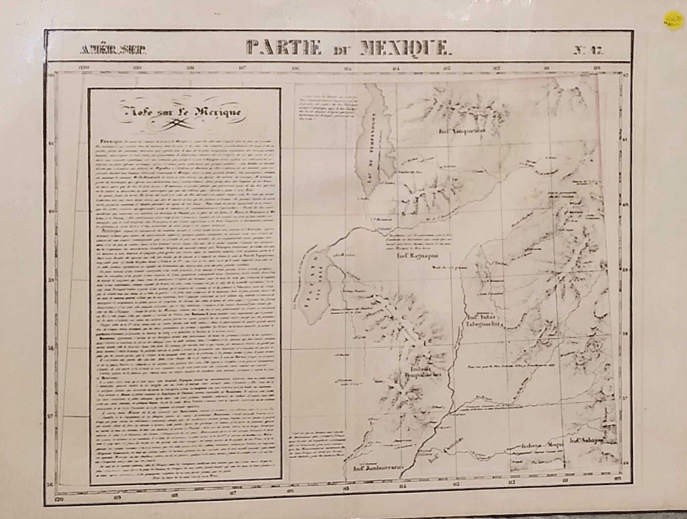
Partie du Mexique. Amér. Sep. N: 47
[Brussels]: 1827. Map. 27 inches by 21 inches. Some closed tearing along the center fold line. Moffat, 3. Item #57374
An early view of Utah, with information from Miera including Lac de Timpanogos (Uintah Mountains), and Rio de Sn. Buenaventura (Green River) flowing WSW into Teguayo Lac Sale (Sevier Lake). Shows the route of the Dominguez-Escalante expedition. Interestingly, a note supposing northern Utah to be the ancestral homeland of the Aztecs is included.
Price: $850.00
See all items by Vandermaelen, Utah Map