![Item #62353 Mexico, California, and Texas [Map]. Drawn and, J. Rapkin.](https://kensandersbooks.cdn.bibliopolis.com/pictures/62353.jpg?width=768&height=1000&fit=bounds&auto=webp&v=1657148421)
![Mexico, California, and Texas [Map]](https://kensandersbooks.cdn.bibliopolis.com/pictures/62353_2.jpg?auto=webp&v=1657148430)
![Mexico, California, and Texas [Map]](https://kensandersbooks.cdn.bibliopolis.com/pictures/62353_3.jpg?auto=webp&v=1657148438)
![Mexico, California, and Texas [Map]](https://kensandersbooks.cdn.bibliopolis.com/pictures/62353_4.jpg?auto=webp&v=1657148449)
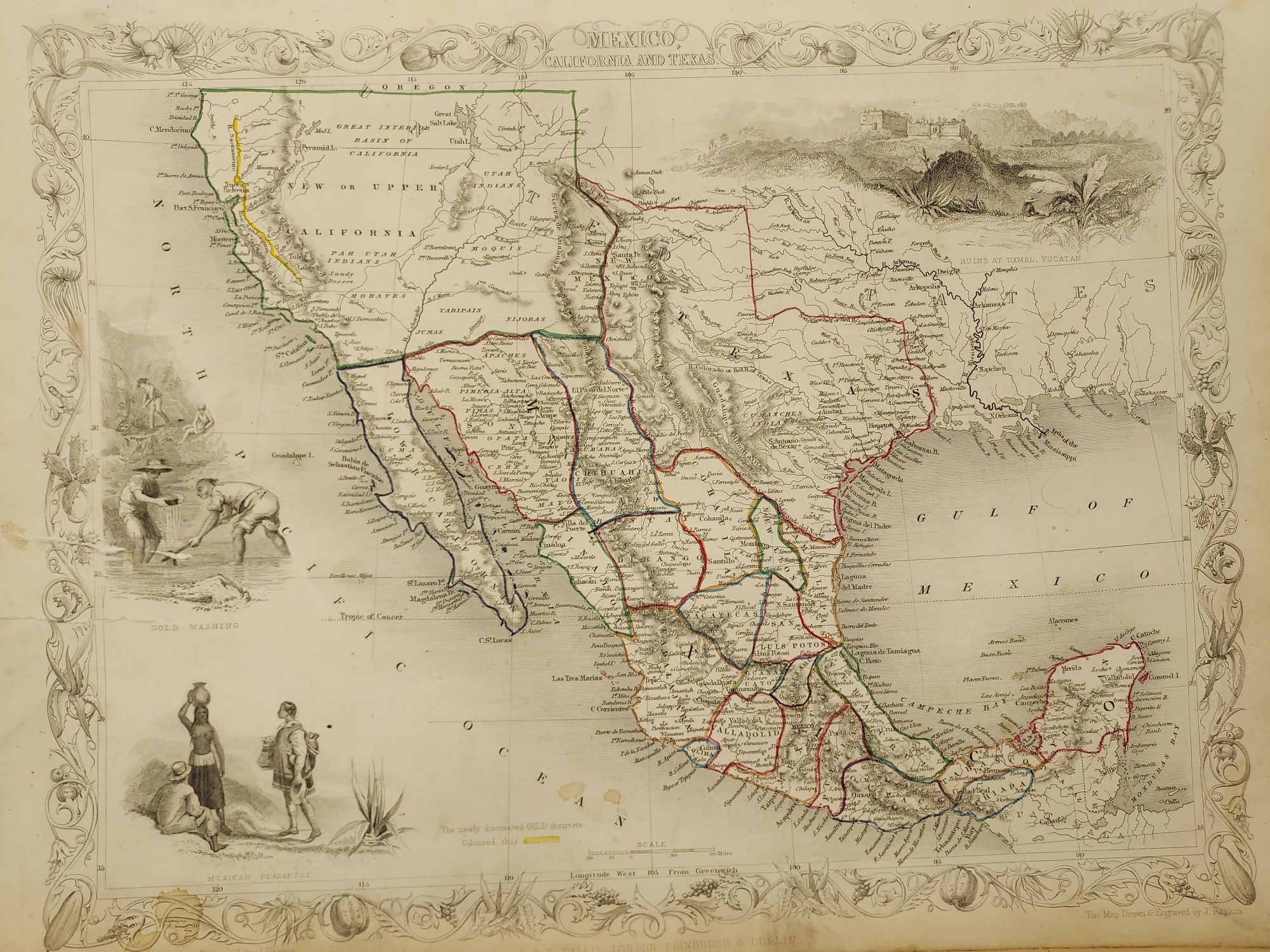
Mexico, California, and Texas [Map]
London, Edinburgh & Dublin: J. & F. Tallis, Circa 1851. Map. 14 3/4 x 10 1/2". Hand colored borders. Decorative fruit and vegetation border. Mexican counties outlined. Most likely from "Illustrated Atlas." With a handful of minor stains to the surface, and two 2 1/4" closed tears to the left margin (backed with a short piece of tape).
Illustrations by H. Warren and engraved by J. Rogers. With vignette scenes of gold washing, Mexican peasantry, and ruins at Uxmal, Yucatan. The newly discovered gold districts are highlighted in yellow. Very good. Item #62353
An early California Gold Rush map, and a map presenting Texas at its largest. Texas includes Santa Fe and the Green Mountains. Illustrates a pre-Gadsden Purchase of the American Southwest. The Colorado River is charted, however Tallis also labels it as the Red River of Texas.
Price: $750.00